
Search cheap land for sale in west virginia and the first two numbers you meet are about $44,800 an acre and about $6,100 an acre, published by the same author on the same site. West Virginia cannot be both.
The $44,800 does not come from a land market. It traces to a page about what it costs to build a house in West Virginia, where land is one line in a construction budget, and that page's own section header says $47,900 while the body beneath says $44,800.
The pages carrying prices carry almost no West Virginia specific risk content. The one page that gets the hard part right, West Virginia Explorer, quoting a named licensed West Virginia agent, leads with split estates, separates timber from minerals and raises flash flooding in hollows. It has zero dollar figures and zero county names.
We name the counties first, then work through what is wrong with them, then hand you the one check that lets you verify any West Virginia price yourself. Every per-acre figure here is a listed asking price rather than a recorded sale, unless we label it otherwise. For the national picture, see our guide to the cheapest places to buy land.
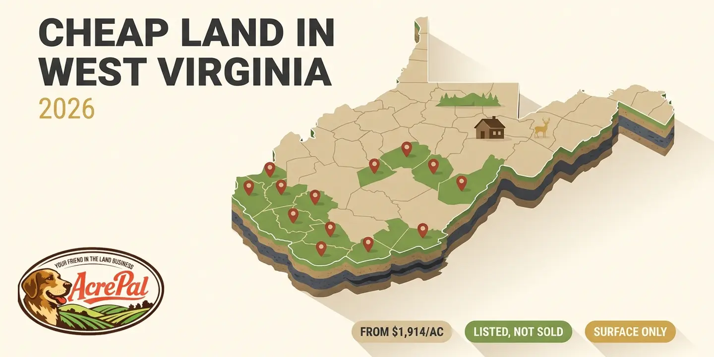
1. The Cheapest Counties in West Virginia and What Their Listings Really Say
The guide ranking at the top of this search lists targeting less competitive areas as its first tactic, then names zero counties. Here they are.
McDowell anchors the southern coalfields and shows the problem best. One source returns a listed median near $2,859 an acre. Another gives an average near $6,900 for undeveloped listings only, against a sold median closer to $1,970. Roughly 16 properties are for sale in the whole county, averaging about $42,244 listed across a mixed sample including houses.
Wyoming, Mingo and Logan sit in the same coalfield region, with no figure solid enough to print. Central West Virginia runs in the same band, with Braxton around $1,914 an acre, Calhoun around $2,500 and Webster around $5,763. An unattributed blog post adds Pocahontas at $2,400 and Clay at $2,100.
Raleigh appears at $5,200 on one page and around $4,143 on another, and we are not averaging them. Regional guidance puts wooded hunting ground in Webster, Nicholas, Randolph and Pocahontas at roughly $1,500 to $3,500 an acre, under Webster's own published median. Gilmer, Roane and Wirt sit in the same band by reputation, with no figures behind them.
None of those figures could be re-read at the source, because the listing marketplaces block automated checks. They are asking prices as reported, and the bands matter more than the decimals.
Prices climb in the Eastern Panhandle and around Morgantown, where Jefferson, Berkeley and Monongalia carry a commuter and university premium in five figures per acre. The one competing page that names counties spends four of its six county sections on those. Kentucky runs on the same coalfield economics, covered in our cheap land in Kentucky guide.
Best for ranking counties before you start looking. Skip using them as a budget, because the next item explains what they are.
2. Why No Honest Source Can Hand You a West Virginia Price Table
Nobody can hand you an honest table of West Virginia per-acre prices by county, including us, and the reason is worth more than the table would be.
For one state, this search publishes $44,800 and $47,900 from a home building cost page, state figures of $6,609, $6,100, $5,928 and $5,741, a southeast regional median of $5,238, and county figures in the low thousands with a floor near $1,900. Roughly 24 times, top to bottom.
The dominant cheap-land page offers the $44,800 as a widely cited benchmark for the state average, lifted from that construction page. Its author publishes about $6,100 an acre elsewhere on the same site, 7.3 times apart in one publisher's coverage of one state.
Every county price on the most county-specific page is credited to a name styled like a data vendor. It is one blog post dated June 12, 2025, by an individual author with no methodology and no named source.
Three problems sit under all of it. They are asking prices, and not one page says so. The samples are tiny, one county's figure resting on roughly 16 listings. Average listed tract sizes run to hundreds of acres, so a median blends a roadside lot against a timber tract of several hundred, and per-acre price falls as tract size rises.
West Virginia Explorer, quoting a named licensed West Virginia agent, gets the hard part right. It leads with split estates, separates timber from mineral rights, raises flash flooding in hollows and legal access, and cites West Virginia University on soils and septic. It also carries zero dollar figures and zero county names. The prices sit on the pages that will not tell you the risks, and the risks sit on the page that will not tell you the prices.
Rank counties on published medians, price the parcel off its own listing, and take the next item to get a real number. Our how much your land is worth breakdown covers the seller's side.
3. The Transfer Stamp: How to Find Out What Land Near You Actually Sold For
One check turns every number above into something you can verify. It is free, and it works here while failing in most states people compare West Virginia to.
W. Va. Code 11-22-2 charges an excise tax on transferring real property. The state rate is "$1.10 for each $500 value or fraction thereof as represented by the document," the county rate is 55 cents per $500, and a county may raise its share up to $1.65.
Section 11-22-6 requires each instrument subject to the tax, when offered for recording, to carry a declaration of consideration appended on the face or at the end, signed by the grantor, grantee or other responsible party familiar with the transaction. The statute does not say that declaration is public and does not say it is restricted. What is verified is that it sits with the recorded instrument at the county clerk's office, so ask the clerk what is open for inspection.
At a combined $1.65 per $500, a stamp of $1.65 implies roughly $500 of consideration and a stamp of $165 implies roughly $50,000. Because the tax is charged per $500 or fraction thereof, what comes back is a band rather than a price, and county rates vary, so confirm the local rate before you divide.
In Wyoming and the roughly dozen non-disclosure states, consideration is confidential or never recorded, so every median there is built from asking prices. Our Wyoming cheap land guide covers that inverse case.
Before you make an offer, call the county clerk, ask the combined rate, and pull the stamps on the last few recorded deeds in the district.
4. Somebody Else Probably Owns What Is Under It
Crowder and Wentz bought 351 West Virginia acres in 1975 knowing they were buying the surface only. On what they were shown, Ms. Crowder said, "They showed us gas wells, which were these two tracks in a field where a vehicle would go to, to check on them monthly or even less often." She was informed, she was not careless, and she won.
Severance is widespread and long-standing here. One parcel can carry separate owners for the surface, the coal, the oil and gas and the timber, and a deed conveying only the surface does not pass the minerals. No dormant mineral act exists and bills modeled on Ohio's have failed, so a 1901 severance is still live in 2026.
EQT Production Company v. Crowder, No. 17-0968, came out of Doddridge County, where a 1901 lease governed those minerals, and was decided unanimously by the Supreme Court of Appeals of West Virginia on June 5, 2019. EQT cleared 42 acres of forest for a 20-acre well pad. One well took 1.8 million pounds of sand, against 305,000 pounds for every vertical well before it combined.
"A mineral owner or lessee has an implied right to use the surface of a tract in any way reasonable and necessary to the development of minerals underlying the tract. However, a mineral owner or lessee does not have the right to use the surface to benefit mining or drilling operations on other lands, in the absence of an express agreement with the surface owner permitting those operations."
Read the second sentence and you are protected. Read the first and you are not, because the right to work the minerals under your own tract is affirmed in the same breath. Crowder and Wentz stopped the drilling reaching everyone else's land, not the drilling on their own, and won $190,000 across five years of litigation.
The statutory floor is W. Va. Code 22-6A-12. Wells may not be drilled within two hundred fifty feet measured horizontally from an existing water well or developed spring used for human or domestic animal consumption, and the center of well pads may not be located within six hundred twenty-five feet of an occupied dwelling structure. Measured from the center of the pad rather than the property line, 625 feet is smaller than it sounds, and one West Virginia land company's page publishes it as 600 feet.
The limitation may be waived by written consent of the surface owner, recorded with the clerk of the county commission, and a prior owner's waiver runs with the land. Buying the surface does not buy quiet. A title search, a check for a recorded waiver and our deed versus title breakdown tell you where your parcel sits.
5. Where the Genuinely Cheap Parcels Come From, and What You Are Bidding On
Where does a parcel priced at a few hundred dollars come from? Largely out of the delinquent land pipeline, and most guidance describing it is out of date.
The Auditor's office puts the 2022 change plainly. "The tax sale will now happen once a year in each county." And, "Under the new law, there will be one sale conducted by the Auditor's Office in each county courthouse." W. Va. Code 11A-3-5, the sheriff's sale statute, now reads simply as repealed.
Any guide that walks you through a sheriff sale followed by a separate state sale is walking you through a system that no longer exists. Confirm current dates with the Auditor's office.
Asked for an address or other information on certified properties, the state's published FAQ answers, "No, we only receive the legal description from the local Assessor." Refunds come only if the property is found non-existent by an attorney licensed in the State of West Virginia. The state contemplates selling things that turn out not to exist.
That FAQ predates the 2022 overhaul, so read it for how the mechanism works, not when it runs. It says property and minerals throughout, so a cheap parcel in an auction list can be a severed mineral interest rather than land you can stand on.
The Auditor's office is blunt about who that system attracted. "For years, the tax sale has been a root cause of slum and blight. Out of state speculators, many with no desire to turn properties into usable living spaces, would buy properties to make money off West Virginians who had fallen on hard times." If you are shopping this state from somewhere else, that sentence is about you.
Turning a legal description into a mapped parcel, and checking whether back taxes ride with it, is covered in our what an APN is guide, including a buyer who lost more than $73,000 on the wrong parcel. If you cannot locate the parcel behind the description, do not bid.
6. Heirs Property: The Cheap Listing That Cannot Be Cleanly Closed
Some of the cheapest listings here cannot be sold to you cleanly, and the reason is a chapter of the code that does not contain something.
Land passed down without a will ends up held by many co-tenants in undivided fractional shares, sometimes dozens across several generations. What is listed can be one person's fraction, not the parcel.
The Uniform Partition of Heirs Property Act has not been enacted here. Chapter 37 runs from Article 1 to Article 15 with lettered variants and has no Article 16, where every West Virginia bill proposed to put it. Those bills failed repeatedly, HB 4269, HB 2123, HB 2802, HB 4081 and HB 4575 between 2018 and 2022. Legislatures act every year, so confirm that is still true.
Partition runs instead under Chapter 37 Article 4, where section 37-4-1 gives the circuit court jurisdiction and any single co-tenant can force a sale of the whole tract. The Uniform Act adds protections against exactly that, including notice, appraisal, a co-tenant buyout right and a preference for partition in kind.
This explains why some cheap listings are fractional interests that never close. It also means buying a fraction is a way to force a sale on a family, the pattern the Auditor's office described in item 5. It happens, and you should not be doing it.
Ask whether the seller owns the entire fee or an undivided share, and get that from the deed, not the listing. A price that looks impossible for the acreage is often a fraction of it.
7. Slope and Water: The Two Tests You Can Only Run on Foot
"Most slopes in West Virginia are vulnerable, especially after heavy rain or snow melt." That is the state's own geological survey, in its homeowner's guide to geologic hazards, and it is a much larger claim than the steep-land-costs-more line every other guide settles for.
That guide names the surface indicators, "hummocky surfaces, leaning and bent trees or utility poles, many seeps and sag ponds." On raw land there is no house to crack and no foundation to shift, so the ground and the trees are your only instrument, free to read.
The free WV Landslide Tool at mapwv.gov/landslide, from the West Virginia GIS Technical Center, holds a statewide inventory of 196,302 landslide features mapped from LiDAR at 2-meter resolution. Its own disclaimer says the study "is limited to a county-level analysis, suitable only for planning purposes and not site-specific analysis or remediation." Use it to screen a parcel out, never to clear one, because a low reading is not a clean bill of health for a building site.
Slides here are both natural and man-made, WVGES says. Tree roots supply meaningful shear strength on weak-bedrock hillslopes, so clearing a wooded slope can cut stability for years. The cheapest parcels are wooded and the instinct is to clear a building site, which makes this the rare hazard a buyer creates.
Water gets less warning than slope and deserves more. On June 23, 2016, roughly 8 to 10 inches of rain fell in about 12 hours onto ground that was already saturated, and 23 people died. Meteorologists put parts of Kanawha, Fayette, Nicholas, Summers and Greenbrier counties at a thousand-year event. Roughly one in four of the flood insurance claims filed in the disaster-declared counties came from outside the mapped 100-year floodplain, per FEMA reporting.
In hollow topography water arrives off the slope, not up from the river, and the mapped zone follows the river, so the FEMA map is necessary and not sufficient. Walk the parcel yourself a day or two after heavy rain, and look at the trees and the ground before the price.
8. What Coal Left Behind, Under the Parcel and On Top of It
Two questions a listing will never answer. What is under the parcel, and what was left on top of it.
W. Va. Code 33-30-6 runs a state mine subsidence reinsurance program, and coverage attaches automatically to property policies in most counties unless the insured waives it. In fifteen named counties it works the other way around, where "A waiver is not required and the coverage may only be provided if requested by the insured." Those are Berkeley, Cabell, Calhoun, Hampshire, Hardy, Jackson, Jefferson, Monroe, Morgan, Pendleton, Pleasants, Ritchie, Roane, Wirt and Wood.
That program insures structures, so raw land has nothing to insure. Its value is as a signal, because the list shows where the state does and does not presume undermining. It does not say those fifteen counties are free of undermining, and neither do we.
Abandoned mine lands means coal mines abandoned before August 3, 1977, the day the federal surface mining law took effect. Workings older than that date have a federal reclamation fund behind them. Nothing before it was required to clean up after itself. A research report from the Ohio River Institute puts West Virginia's at 173,000 acres, with reclamation costs estimated at $5 billion.
WVDEP publishes an AMLPoints layer on its open data portal, and the federal Office of Surface Mining Reclamation and Enforcement runs e-AMLIS, a public inventory of those impacts and their reclamation cost. On the ground you are looking for highwalls, portals, refuse piles and tipples. A highwall is the exposed vertical rock face left by surface mining, the one a buyer is least likely to recognize as a permanent liability.
Run the county through both before you pay for a survey or a title search.
9. Managed Timberland: The Holding Cost Lever Nobody on This Search Mentions
Every guide here sells low property taxes and stops there. Not one of them mentions the program that actually moves the number.
Lowest property taxes in the nation is not true of the rate. The Tax Foundation puts it at 0.51 percent effective on owner-occupied housing value, and Hawaii is materially lower. The state is widely reported to have the lowest or close to the lowest median annual bill, though published figures disagree, roughly $730 to $881.
That bill is small mostly because property values here are low, which makes it a strange thing to sell a cheap parcel on. Cheap land was always going to have a small tax bill.
At roughly 78 percent forested, most cheap parcels here are wooded. W. Va. Code 11-1C-2(b) defines managed timberland as surface real property, farm woodlots excluded, of at least ten contiguous acres devoted primarily to forest use, carrying at least forty percent normal stocking of commercially valuable species well distributed over the growing site, and managed to a plan.
All four thresholds must hold. Contiguous means two separate five-acre parcels do not add up, and the stocking test can fail a clear-cut parcel even at 40 acres.
Section 11-1C-10 requires the owner to certify every five years in writing to the Division of Forestry and to contract to manage it under the state's "Best Management Practices for Forestry." Certified property "shall be valued according to its use and productive potential." The initial contract is due before July 1 and recertification by September 1 every fifth year. You are signing up to manage the woods, not checking a box on a tax form.
Under 11-1C-11b it must always be valued below comparable uncertified timberland in the same county, so the bill goes down, and we will not say by how much because no verified figure exists. Confirm current procedure with the Division of Forestry and the county assessor.
If your parcel runs ten or more contiguous wooded acres and you are willing to manage it to a plan, file before the July deadline and treat it as part of the return, alongside other ways to make land pay. Under ten acres, or if the plan is to clear the trees, it is not available to you.
10. Legal Access, and What an Out-of-State Buyer Actually Finds
A parcel you cannot legally reach is not cheap, it is a lawsuit with a price tag, and the sources publishing the rules disagree with each other.
Ten years is the period commonly stated for a prescriptive easement here, for use that is adverse, meaning without permission, continuous, uninterrupted and obvious enough that a reasonable owner would have noticed. It ties to the limitation period at W. Va. Code 55-2-1. Commercial land sites publish 7 years and 20 years, neither supported, and adverse possession, a different doctrine, ranges from 10 to 15 years across sources. Take it to a West Virginia attorney rather than another confident page.
Touring West Virginia parcels from out of state, one buyer documented a shared and gated access easement with an undisclosed abandoned house along it, leaving open who else holds rights over it. She flagged a culvert she doubted would carry a loaded logging truck.
Twice she found that horse pasture in a listing meant wet ground that would not support septic. West Virginia agents, she noticed, often hand an out-of-state buyer directions rather than walking the parcel with them.
Perc, well and utility costs sit in our guides to perc test costs, digging a well in 2026, getting utilities on land and rural zoning codes.
Recorded legal access is the one thing you cannot fix after closing. If you cannot get there yourself, pay somebody local to walk it and photograph the way in.
11. What Your Budget Actually Buys, and Who Sells It
Nothing on this search defines cheap. One page titled cheap West Virginia land lists four properties whose cheapest total price is $44,900, a different product from a cheap price per acre.
Cheap per acre on a big tract and a cheap total ticket on a small parcel are different purchases, blurred constantly. The marketplaces that run a cheap West Virginia filter are showing you a self-selected subset, and any average they publish across it is an average of asking prices rather than a sold benchmark. We are not quoting one, because the pages that carry those averages blocked us from reading them at the source.
Run that against the bands in item 1 and the arithmetic is unforgiving. At a listed $2,000 an acre, $20,000 is about ten acres. At $5,000 it is four. The very cheapest tickets come out of the tax channel in item 5.
Banks are hard on raw land, so owner financing is common on cheap rural parcels and worth asking about even when unadvertised. Keep down payments and per-acre prices separate, since a $999 down offer says nothing about price per acre, as a direct competitor on this search demonstrates. Our playbook on buying land with no money down walks the mechanics.
One note on who we are. This no-bank owner-finance model is how AcrePal sells rural land, but in Arizona, Colorado, Nevada, California and Florida, not in West Virginia, so West Virginia buyers work with West Virginia sellers. We did the same breakdown for Tennessee next door.
Best for the buyer who wants acreage and will do items 4 through 8 first. Skip West Virginia if you want a parcel you can buy off a listing page without a title search, because that buyer is the one this state punishes.
Frequently Asked Questions
What is the cheapest county to buy land in West Virginia?
McDowell and the southern coalfield counties, with Braxton, Calhoun and Clay in the same band, roughly $1,900 to $2,900 an acre on listed medians. Those are asking prices reported by listing marketplaces, not recorded sales, on samples as small as 16 listings for a whole county. Rank counties with them, do not set a budget.
Is West Virginia land really $44,800 an acre?
No. It comes from a page about the cost of building a house in West Virginia, where land is one line in a construction budget, and that page's own header says $47,900 while the body says $44,800. The same author on the same site publishes about $6,100 an acre elsewhere.
Can you find out what land in West Virginia actually sold for?
Yes, and that separates West Virginia from most states people compare it to. The state charges $1.10 per $500 of consideration, counties charge 55 cents up to $1.65, and a declaration of consideration is appended to the recorded instrument the clerk holds. Work backward from the stamp to a band, confirm the county rate, and ask the clerk what is open.
Does West Virginia have the lowest property taxes in the nation?
Not on the rate. The effective property tax rate here is 0.51 percent and Hawaii is materially lower. West Virginia is widely reported to have the lowest or close to the lowest median annual bill, though published figures disagree, roughly $730 to $881. That bill is small mostly because property values are low.
Do you get the mineral rights when you buy cheap West Virginia land?
Often no. Severance is widespread and long-standing, a deed conveying only the surface does not pass the minerals, and West Virginia has no dormant mineral act, so a 1901 severance is still live today. Under EQT Production Co. v. Crowder, decided in 2019, a mineral owner has an implied right to use your surface as reasonable and necessary to develop the minerals under your own tract.
Where do the cheapest West Virginia parcels come from?
A large share come out of the delinquent land pipeline, which since 2022 is one sale a year run by the State Auditor's office in each county courthouse rather than the old sheriff sale plus a state sale. The state's own FAQ says it receives only the legal description and has no address, and severed mineral interests move through the same channel. Confirm current dates with the Auditor's office.
Is West Virginia land safe if it is outside the FEMA flood zone?
Not necessarily. In the June 2016 flood, roughly one in four of the flood insurance claims filed in the disaster-declared counties came from outside the mapped 100-year floodplain, per FEMA reporting. In hollow topography water comes off the slope rather than up from the river, and the mapped zone follows the river, so the map is not sufficient.