
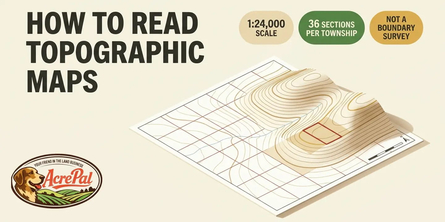
You have the listing open in one tab, a satellite view in another, and a topographic map of the parcel in a third. The topo map, the one covered in brown squiggles, describes the shape of the ground rather than what sits on it, and it is the one most buyers close without reading. How to read topographic maps for a parcel you might buy is a different job than reading one for a hike.
We pulled five of the pages ranking for this phrase and counted. Across 8,331 words, the word parcel appears zero times. Deed, zero. Legal description, property line, plat, easement and PLSS, all zero.
Across those same five pages, hiking, backpacking and trail appear 39 times. The number one organic result belongs to Hall & Hall, a ranch brokerage, and its article body runs roughly 300 words with almost no numbers.
Those guides are not wrong. They are written for somebody walking the land, not somebody buying it. What follows is the order we would work a map we just downloaded, including how to match a deed call to the grid printed on the quad and an honest account of what the map cannot tell you.
Step 1: Read the Map Margin Before You Read the Terrain
Open a quadrangle and your eye goes to the terrain. Everything deciding whether it means anything is printed outside it, in the margin called the collar. One number you would expect there was removed on purpose.
Pull the map from USGS topoView or The National Map Downloader. Write down four things before you read a contour line.
Contour interval. Your resolution ceiling, and Step 3 is built on it. It varies by map and it is printed in the collar, so read it off your own sheet.
Scale. 1 to 24,000 means one inch on the paper is 24,000 inches on the ground, or 2,000 feet. A bigger denominator means a smaller scale and less detail, which runs backwards from how it sounds.
Datum. The reference model the coordinates hang on. "Most USGS topographic maps published through 2006 use NAD27. US Topos (published after 2008) are georeferenced to NAD83 or WGS84." In the conterminous 48 states, the graticule shift "is in the range of 10-100 ground meters", roughly 33 to 328 feet, while "Changes to UTM values are generally larger, around 200 meters".
USGS gives one instruction. "If you're using a topographic map and a GPS device, be sure that your device is set to the map's datum."
Edition year. A field-checked historical quad or a modern US Topo. Step 7 is where that difference costs you.
Now the missing number. "US Topo maps are as accurate as the data sources used to make them, but because these sources are many and varied, it is not possible to make a single simple statement that the map as a whole meets a particular level of accuracy." So, in USGS's words, "US Topo maps, therefore, do not have a traditional accuracy statement in the map collar." That is not sloppiness.
Only the aerial photograph underneath carries a figure, an "accuracy of 6 meters", about 20 feet. A parcel with no buildings, road or poles gives the map the least to work with, which is where most unimproved land buyers start. Write those four down. Every step after this one depends on them.
Step 2: Find Your Parcel Using Section, Township, and Range
Your deed says the NW 1/4 of the SE 1/4 of Section 14, T21N, R18W. That is 40 acres of real dirt, and the same numbers are printed on the quadrangle covering it.
Gaia GPS is the only ranking page that mentions township and range at all, and it frames the grid as a distance trick, since each numbered box is a square mile. True, and one step short of what a buyer needs.
USGS describes it plainly. "The Public Land Survey System (PLSS) is a way of subdividing and describing land in the United States."
"The PLSS typically divides land into 6-mile-square townships. Townships are subdivided into 36 one-mile-square sections. Sections can be further subdivided into quarter sections, quarter-quarter sections, or irregular government lots."
It is not national. "PLSS surveys, which are available for portions of land in 30 southern and western states, are made by the Bureau of Land Management (BLM)." All five states we sell in are PLSS states.
Read the legal description right to left.
- Range and township. R18W and T21N locate one six mile square block.
- Section. Section 14 locates one square mile inside it.
- The quarter calls. The SE 1/4 gets you to 160 acres, the NW 1/4 of that to your 40.
The acreage math is in how many acres is a section of land, and metes and bounds and lot and block are different systems, covered at what a plat map is.
Whether the grid prints depends on the edition year from Step 1. "For states that have Public Land Surveys: Almost all historical topographic maps (1884-2006) include PLSS tic marks or gridlines. US Topo maps published 2009-2012 do not include any PLSS data. US Topo maps published 2013-present have a Public Land Survey System layer that can be turned on and off. OnDemand Topo maps published 2022-present have the option for a Public Land Survey System layer that can be turned on and off." Download a 2011 US Topo, find no section lines, and you have done nothing wrong.
Now the part that keeps this honest. "PLSS was created to divide parcels of public land; it's not useful for the accurate location of points and shouldn't be confused with coordinate systems like latitude/longitude, UTM, or the State Plane Coordinate System."
The legal standing is stated too. "US Topo maps are not legal documents and the Public Land Survey System (PLSS) representation is not legally authoritative. The sections, townships, and ranges of the PLSS that are shown on US Topo maps are derived from GIS data from the Bureau of Land Management (BLM) in cooperation with the Federal Geographic Data Committee (FGDC)." That data is public, on the BLM national PLSS service.
Mohave County, Arizona publishes a TOPOGRAPHY map service with two layers, "US Topo Quadrangle Map Boundaries (24K)" and "50 ft Contour Lines". Switch on contours in the county viewer and you get terrain and parcel boundary in one window, which no generic topo tool offers. That 50 foot interval is coarse, and Step 3 explains the cost. Elsewhere, ask your county GIS or assessor department and bring the parcel number, because the county files by APN and your deed by legal description.
The grid gets you to the right square mile and the right 40 acres on paper. Only a survey puts the corner on the ground.
Step 3: Read Contour Lines and the Contour Interval
Five minutes here makes every other line on the map readable. A contour line connects points of equal elevation. Walking along one means walking level. Crossing one means gaining or losing exactly the contour interval.
If the definition is not landing, put a rock in a bathtub, fill it, then drain the water an inch at a time, drawing the waterline on the rock at every stop. Those rings are contour lines, and the inch between them is the interval.
Spacing carries most of the meaning. Lines crowded together mean steep ground. Lines spread far apart mean gentle ground. Evenly spaced lines mean a constant grade, the kind a road can follow.
A wide blank area is flat ground. On a parcel that is usually where the building pad goes, and Step 6 puts a number on it.
Every fifth contour is drawn heavier and labeled with its elevation. Those are index contours, and they save you counting forty lines up from the bottom of the sheet. That is standard cartographic convention rather than a USGS rule we can quote, but it holds on the quads you will pull.
Reading an elevation off the map takes three moves.
- Find the nearest heavy labeled line. Say it reads 4,600 feet.
- Count the lines to the spot you care about. Say three, going uphill.
- Multiply by the interval and add. At a 50 foot interval, three lines is 150 feet, so your spot sits around 4,750 feet.
Now the part the hiking guides skip. The interval is not trivia, it is a ceiling on what the map is permitted to show you. Mohave County's contour layer runs at 50 feet, so a 49 foot drop can hide between two adjacent lines. That is a four story fall, a wet weather pond, or a ravine the map does not know about.
That reading is ours rather than USGS's, and it fits the missing accuracy statement from Step 1. A map that will not claim a single accuracy figure is not going to resolve a feature smaller than its own interval.
Somebody posted their hometown quad on X to show how flat Houston is. "50' contour lines. There might be 1. Highest point in houston is about 230' if I remember right." Same interval, opposite failure. On flat ground a coarse interval erases the terrain instead of hiding one piece of it.
Find the interval first. It sets the size of everything the map is allowed to leave out.
Step 4: Identify Ridges, Valleys, Saddles, and Peaks by Shape
The same V shape means two opposite things depending on which way it points. Read it backwards and you have inverted your understanding of where water moves on the parcel, which is the one thing on this map that eventually shows up at your front door.
Seven shapes cover nearly everything you will see. Use the labeled index contours from Step 3 so you always know which way is uphill.
- Peak or hill. Concentric closed loops, each smaller than the last. The smallest loop is the summit.
- Depression. Closed loops with short tick marks pointing inward. Without the ticks it looks exactly like a hill, which is how a beginner reads a sinkhole as a rise.
- Valley or draw. A V or U pointing uphill, toward higher elevation. Water runs the other direction, out the open end.
- Ridge or spur. The same V or U pointing downhill, away from the high ground. This is a finger of land, not a channel.
- Saddle. The low pass between two high points, shaped like an hourglass or the pinch of a figure eight. It is usually the cheapest place for a road to cross a ridge, which is why roads keep turning up there.
- Cliff or near vertical face. Lines crowded until they touch or merge outright. Nothing gets built there and nothing drives up it.
- Bench or flat. A wide gap between lines partway up a slope. On sloping ground this is often the only place a pad and a leach field will both fit.
None of that needs a citation from us. Every competing guide teaches the same shapes and the V rule is standard across all of them. If the shapes are not clicking, USGS runs public education on exactly this, including a hands-on activity for building a three-dimensional topographic model out of a salad tray.
What almost nobody does is finish the sentence. Add the shapes up and you have a rough land budget for the parcel before you have driven a mile. The peaks and cliffs are acreage you will never use for anything but the view. The benches are the acreage you will actually use, and there are usually fewer of them than the listing acreage suggests.
The saddles are where a road wants to cross. And the V's are where water is going to run whether you planned around it or not, which is the next thing to trace.
Step 5: Follow the Water Across Your Acreage
A dry wash in August and a running channel in a September storm are the same feature. The map draws it the same way either way, and on most of the ground we sell there is no blue line to warn you.
Apply the V rule from Step 4 to your own parcel. Every V points to a drainage path, and water runs out the open end. Trace each V from the high corner to the low corner and you have the drainage map of the property.
For a hike, water tells you where to camp. Here it tells you where water crosses ground you would own.
Washes and arroyos across Mohave, Apache, Elko and Modoc are dry most of the year. Plenty carry no blue line at all, because there is no perennial stream to draw. The contours still show exactly where the channel runs. Absence of a blue line is not absence of moving water, and the day you walk the parcel is unlikely to be the day it answers the question.
Water collects in three places you can pick out from contours alone. The low corner of the parcel. The inside of a bend where a channel turns. Any closed contour in a basin rather than on a rise, which the tick marks from Step 4 identify.
Those spots stand water after a storm. A drive crossing a wash wants a culvert, a pad wants to sit off the channel, and a leach field wants to stay out of the low ground.
Two limits. A topo map is not a flood map, and flood zones are published separately by FEMA. And the map shows where surface water goes while saying nothing about what is underground, which we cover in what a well and septic system cost.
Trace the drainage before you pick a building site, and remember the interval from Step 3 caps how small a channel the map can show.
Step 6: Measure the Slope for a Building Site and a Driveway
Four numbers off the map give you a percent grade, the unit every threshold below uses.
USGS states the formula. "Percent of slope is determined by dividing the amount of elevation change by the amount of horizontal distance covered (sometimes referred to as 'the rise divided by the run'), and then multiplying the result by 100."
Contour interval times lines crossed gives the rise. Map distance times the scale denominator gives the run. Work it by hand at a 50 foot interval.
- Count the lines. Four between the road and the pad site.
- Get the rise. 50 feet times 4 lines is 200 feet.
- Measure the map distance. Three quarters of an inch.
- Get the run. At 1 to 24,000, that is 18,000 inches, or 1,500 feet.
- Divide. 200 divided by 1,500 is 0.133, or a 13.3 percent grade.
The same slope as an angle is about 7.6 degrees. Identical ground, two units, and 13.3 percent sounds worse than 7.6 degrees, so check which unit a rule uses.
USGS adds a caveat to its own method. "The 'run' assumes you're traveling on an idealized flat surface - it does not account for the actual distance traveled once elevation change is factored in." A runner on X said the same, that calculating from GPS on a topo map "will almost always slightly underestimate both because switchbacks & small undulations between contour lines are missed." Your real driveway is longer than your run.
Contour Slope Calculator
Read the contour interval off the map collar, count the lines your route crosses, and measure the distance. This turns those three numbers into a grade, and tells you what that grade rules in or out.
Already know the ground distance? Enter it here and it overrides the two fields above.
Average grade
13.3%
200 ft of rise over 1,500 ft of run
WHAT THAT GRADE RULES IN OR OUT
This is the average grade between the two points you measured, not the steepest pitch along the way. Contour lines cannot show a drop smaller than one interval, so a short cliff or gully inside your measurement will not appear here. The two California figures come from that state's statewide OWTS Policy and are shown as a familiar benchmark. Your county sets its own numbers, and a county operating an approved Local Agency Management Program may differ. Check locally before you rely on any of this.
Three published thresholds are worth measuring against.
Fire apparatus access, 10 percent. International Fire Code, Appendix D, section D103.2.
D103.2 Grade. Fire apparatus access roads shall not exceed 10 percent in grade. Exception: Grades steeper than 10 percent as approved by the fire chief.
The worked example lands at 13.3 percent, over that line. Adoption varies by jurisdiction, and the fire chief exception is part of the rule.
Septic dispersal, 25 percent in California. The state's OWTS Policy, section 7.7, under Tier 1. "Natural ground slope in all areas used for effluent disposal shall not be greater than 25 percent."
Slope stability report, above 30 percent in California. The same policy, at 9.4.4 and 10.6.4, lists among restricted conditions "Slopes greater than 30 percent without a slope stability report approved by a registered professional."
Those last two are different rules and collapsing them gets both wrong. California is our market through Modoc County, and a county running an approved Local Agency Management Program sets its own standards. Pricing for the test is in what a perc test costs.
There is no universal maximum buildable slope. We went looking and did not find one, because buildability is a cost and engineering question, not a bright line. Steep ground gets built on. It costs more, and the driveway still has to reach a road across whatever right of way exists.
Run the grade before you fall in love with a view lot. The number decides the driveway and the septic layout before anything about the house.
Step 7: Know What a Topographic Map Will Not Tell You
USGS publishes the limitation itself, blunter than anything a brokerage would write.
Boundaries first. "USGS topographic maps are general reference publications and can't be used as legally authoritative sources for boundary information or litigation." Elsewhere the agency draws it wider. "USGS maps and geospatial products are intended for general reference and are not authoritative or official for navigation or for any regulatory purpose."
The drawn lines wander for a reason. "Unlike hand-drawn Historical USGS Topographic Maps (published 1884-2006), boundaries on computer-generated US Topo and OnDemand Topo maps don't always align perfectly when boundary lines from several sources are combined." A topo map is not a survey, and what a land survey does covers what that document can and cannot settle.
Then the empty map trap. USGS names the feature classes the historical 7.5 minute series carried and US Topo does not. "recreational trails, pipelines, power lines, survey markers, many types of boundaries, and many types of buildings". USGS gives the reason. "The USGS no longer does field verification or other primary data collection for these feature classes, and there are no national data sources suitable for general-purpose, 1:24,000-scale maps."
The list is not exhaustive, since USGS adds feature classes over time. Power lines, survey markers and unimproved roads are exactly what a remote buyer goes looking for, and singling those out as the ones that sting is our read rather than USGS's. A blank parcel on a modern US Topo is a statement about the map, not about the parcel.
The trade has another half. Historical maps were "compiled, drawn, and edited by hand" while US Topo is "mass-produced from secondary sources". In exchange, "Individual layers can be turned on and off to allow map customization and the inclusion of more data. US Topo maps include a high-resolution aerial photograph (orthoimage). Thanks to automated production, US Topos have a rapid national refresh cycle (3 years), as opposed to 45 years for the historical 7.5-minute map series."
Fewer feature classes, refreshed roughly fifteen times more often. Pull both editions of your quadrangle from topoView and compare.
Two more absences. The map does not say whether you have legal access, which is what makes land landlocked, or what you may build, which is rural residential zoning and belongs to your county.
The map is good for shape, water and grade. It was never going to tell you where your corner is, who maintains the road, or whether the county will let you build.
Topographic Map Questions Land Buyers Actually Ask
Does a topographic map show my property lines?
No. US Topo editions from 2013 onward can print PLSS section, township and range lines from BLM, but USGS states that the representation is not legally authoritative and that its maps cannot settle boundaries or litigation. The grid shows which square mile you are in, not where your corner is.
How do I find my parcel on a topo map using my deed?
Read the legal description right to left. Range and township find the six mile block, the section number finds the square mile, and each quarter call halves it again. It works only in PLSS states. Step 2 walks a full call, and how many acres is a section of land covers the math.
Why does my topo map show no roads or buildings on my land?
Because the current US Topo product does not carry those feature classes yet. Trails, pipelines, power lines, survey markers and many buildings appeared on the old field-checked quads, as Step 7 quotes USGS explaining. Pull the historical edition from topoView and they may be sitting right there.
My phone and my topo map disagree about where I am. Which one is wrong?
Probably neither, because they are on different datums. Maps published through 2006 use NAD27, US Topos after 2008 use NAD83 or WGS84, and the shift runs 10 to 100 ground meters, roughly 33 to 328 feet. UTM values move further still. USGS's instruction is to set your device to the map's datum.
How steep is too steep to build on?
There is no universal number and we are not going to invent one.
The International Fire Code caps fire apparatus access roads at 10 percent grade unless the fire chief approves something steeper. California's OWTS Policy caps effluent disposal areas at 25 percent under Tier 1, with a slope stability report required above 30 percent. Your own county governs.
Where can I get a free topo map of a specific parcel?
USGS topoView and The National Map Downloader are free and official. In Mohave County the county viewer shows contours and parcel lines together. Everywhere else, ask your county GIS department. If you are still choosing a parcel to read all this against, our current listings are here.