
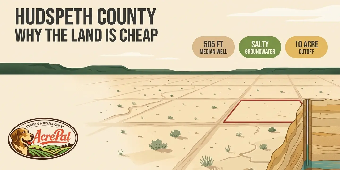
Twenty acres in West Texas. A few hundred dollars down, something like $150 to $300 a month, no credit check and no bank involved. If your first reaction to that ad was to go looking for the scam, that reaction is healthy. It is also, in the narrow sense, usually wrong.
The lots being advertised in Hudspeth County, Texas are generally real. They are surveyed, they are recorded, and the deed you get at the end is a deed. The price is low because of what the land is and where it sits, and every one of those reasons is checkable against a public record that already exists. That is the part the sales page skips.
Search for land for sale in Hudspeth County, Texas and almost every result is a page written by someone with a financial interest in your answer. We read three of them end to end, from Discount Lots, Sunset Ranches and Your Cheap Land, and every criticism below applies to those three only.
Our own interest, up front rather than buried at the bottom. We sell rural land in the West, in Arizona, Colorado, Nevada, California and Florida. We do not sell in Texas and we gain nothing from whatever you decide here. An article that criticizes land sellers cannot hide that it was written by one, so that is the disclosure, once, and we will not raise it again.
What follows is four reasons the price is what it is, each tied to a source you can pull yourself, then what the low tax pitch really means and a checklist for one parcel. We also pulled the state's well report database, 707,498 filings, for the 174 that come from this county. None of those three pages publishes anything like it, and where we could not source something we say so instead of guessing.
Where Hudspeth County actually is
Hudspeth County is the third largest county in Texas by land area and it holds about 3,403 people. That population comes from the Census Bureau's American Community Survey five year estimates covering 2020 through 2024. The Texas State Historical Association describes a county that "covers 4,566 square miles of terrain in the Rio Grande basin", while Wikipedia gives 4,572 square miles. We are not going to average two sources that disagree, so use the TSHA figure and know the other one exists.
It sits in the Trans-Pecos, far West Texas. New Mexico is the northern border, the Mexican state of Chihuahua is the southern one, and El Paso County is to the west. The county seat is Sierra Blanca, roughly 70 miles southeast of El Paso, and its courthouse is "the only adobe courthouse in Texas". The county entirely observes Mountain Time, which is unusual for Texas and tells you how far west you really are.
Scale is the thing to hold onto. Median value of an owner-occupied home here is $64,000, from that same Census release. Cornudas, a named place on the map, had nineteen residents in 2000 and five by 2009. A dot on the map in this county can be five people.
One thing no page selling land here tells you is that Hudspeth is really three different places, and your parcel is in exactly one of them. Dell Valley in the northeast is irrigated farm country over the Bone Spring-Victorio Peak aquifer. The Diablo Plateau, the high open country through the middle and west, is where most of the cheap subdivision acreage is. The southern strip along Interstate 10 and the Rio Grande is where the towns are.

Different aquifers, different water quality, different school districts, different tax rates. Find out which of the three your parcel sits in before you read another word, because everything below splits along those lines.
Reason one, the water is deep and it is salty
The Texas Water Development Board keeps a database called Submitted Driller's Reports. Licensed Texas drillers must file a report on every well they put in the ground, and those filings are public. The statewide export holds 707,498 well reports. We downloaded it, filtered to Hudspeth County, and got 174 reports dated 2002 through 2026.
Fifty nine were filed as domestic wells, the category that matters if you intend to live on the parcel. Here is what the drillers themselves reported.
- Median total depth, 505 feet, and mean depth, 518 feet
- Shallowest, 80 feet, and deepest, 1,600 feet
- 31 of the 59, or 53 percent, went 500 feet or deeper
- Six went past 1,000 feet, and 14 came in shallower than 200 feet
- Where a static water level was recorded, on 42 of them, the median sat 390 feet below the surface, ranging from 25 to 1,309 feet

The caveats belong here and not in a footnote. 174 wells across 4,566 square miles over roughly 24 years is thin, and it is still the best data that exists. The database begins in February 2001, so anything older is absent. These are county-wide figures, we did not map the coordinates against subdivision boundaries, and a filed report proves only that a hole reached a depth, not that it produced usable water.
Getting the next part right is the difference between this article and everything else on the subject. TWDB Report 364, the hydrogeology study for this county, states that "Water level elevations range from about 4,000 to 4,600 ft in Cretaceous rocks and about 3,400 to 3,600 ft in Permian rocks".
Those are elevations above sea level, not depths below your feet. Depth on a parcel is its ground elevation minus the water elevation beneath it, and TSHA puts ground here at "elevations ranging from 3,200 to 7,500 feet above sea level". Two parcels in one subdivision can differ by hundreds of feet of drilling, which is why no listing page can honestly quote your well depth.
Depth is only half the problem. Report 364 finds that "Water quality on the Diablo Plateau is generally slightly saline with total dissolved solids values of 1,000 to 3,000 milligrams per liter", and that "In the Dell Valley area, salinity increases to moderately saline in the 3,000 to 10,000 mg/L range." The EPA secondary standard for total dissolved solids is 500 mg/L, so plateau groundwater runs two to six times that standard and Dell Valley six to twenty times it.

Even the county's better water is relative. Report 364 says "Southeast Hudspeth County generally has fresh water with total dissolved solids values of less than 1,000 mg/L". Fresh, in that report, means under 1,000, which is still twice the secondary standard.
That standard is not a health limit and we will not pretend it is. EPA lists the noticeable effects of high dissolved solids as "hardness; deposits; colored water; staining; salty taste", and it does not enforce secondary standards at all.
So this water is not unsafe because of that number. It is salty, hard on plumbing and appliances, often unpleasant, and treating it is a recurring cost that none of those three pages mentions.
Then there is the sentence that settles whether anyone can promise you water. On the aquifer under most of the cheap acreage, Report 364 says "Little information is currently available on the Diablo Plateau aquifer, but it may be able to produce moderate amounts of fresh water." Pumping up there today, the same report notes, "is limited to scattered wells used for livestock or domestic purposes". The state's own hydrologists say they do not know.
Reason two, Dell City already ran this experiment
This county has already tested the bet you are being asked to make, and the results are in the historical record. Groundwater was discovered near Dell City in the late 1940s, and an agricultural boom followed it. For about a decade, it worked.
Then the Handbook of Texas records what happened next, that "by the mid-1950s intensive pumping had significantly lowered the water table". Agricultural income fell "from $5,701,810 in 1950 to $1,947,067 in 1954, due to the lack of salt-free water". One operation went "from 100 employees to three".

Read the cause in that middle quote carefully. The binding constraint was not simply that the water ran out. It was salt, which is the same constraint TWDB Report 364 was still measuring half a century later.
Now the fair reading, because we are not trying to frighten you off. None of this means a domestic well will fail on your parcel. A household uses a tiny fraction of what irrigated farming uses, and the two are not comparable in volume. What it does mean is that the limits of the water here are documented local history rather than speculation, and the people who found those limits were farmers with capital, equipment and ground knowledge.
There is a live mechanism attached to that history. The Hudspeth County Underground Water Conservation District No. 1 pegs its permitted allocation to a two year monthly moving average of the water surface elevation in a single monitoring well, identified in its rules as TWDB Well No. 48-07-516. When the measured water level drops, the allowance drops with it. The district that manages the aquifer wrote that ratchet into its own rules, which tells you what it expects the water to do.
Reason three, nobody has to bring you utilities or grade your road
The standard assurance on a Hudspeth listing is that the tract has access to a dedicated public roadway. Three separate things hide inside that phrase. Dedication is an offer of a road, acceptance is the county agreeing to take it, and maintenance is somebody actually grading it after a storm.

The Texas Association of Counties, in its legal publication on common road and bridge questions, states the general rule plainly. "Generally, a county may not repair or maintain a private road or property, subject to a few exceptions".
One exception lands squarely on this county. "A constitutional amendment authorizes counties with a population of 7,500 or less to construct or repair private roads if the county charges a reasonable amount for the work." Hudspeth has about 3,403 residents, well under that threshold.
Read the direction of that permission carefully, because it runs the way you would not expect. It lets the county do the work and charge you for it, and it obliges the county to do nothing at all.
A second mechanism runs the same direction. If the commissioners court decides improvement of a subdivision road or an access road is necessary for public health, safety or welfare, it may improve the road to county standards and "assess all or part of the costs of the improvement pro rata against the record owners of the property." A road fix out here can arrive as an invoice rather than as a service.
What we will not tell you is whether any particular subdivision road in this county is on the maintained list. We did not verify that, and guessing would put us in the same category as the pages we are criticizing. Call the county road department, ask for the maintained road list, and get the answer in writing before you close.
Utilities are the same problem with a simpler question underneath. The only number that matters is the distance from your parcel to the nearest line, and out here that is measured in miles. An extension quote from the utility is one phone call, and it is probably the most important one you can make before signing anything.
None of this is unique to Hudspeth County and none of it is improper. It is how remote Texas acreage works. It is simply absent from the three pages we read.
Reason four, the border county buyer protections stop at ten acres
Texas wrote an entire body of law for this exact situation, and most buyers have never heard of it. After decades of border county lots sold to out of state buyers with no water, no sewer and no roads, the legislature built a protection regime into Chapter 232 of the Local Government Code. Subchapter B is that regime.
Start with who it covers. Section 232.022(a) says the subchapter "applies only to" a short list, and the first item is "a county any part of which is located within 50 miles of an international border". Hudspeth borders Chihuahua directly, so it falls squarely inside that description.
What it does is substantial. Section 232.023 requires the subdivider to have a plat prepared, carrying "a description in English and Spanish of the water and sewer facilities and roadways and easements dedicated for the provision of water and sewer facilities", plus a date by which those facilities will be fully operable. It reaches every method of conveyance, contracts for deed and other executory contracts included. Section 232.029 bars a utility from serving or connecting subdivided land with electricity or gas without a determination from the commissioners court that adequate water and sewer service has been installed.
That is real protection, written for people in your position. Here is where it stops.
Section 232.022(b) applies the subchapter "only to land that is subdivided into two or more lots that are intended primarily for residential use", and presumes that intent only when "the lot is five acres or less". Section 232.023(a) makes a plat mandatory only when at least one lot is five acres or less, and leaves it to the commissioners court between five and ten acres. Then comes Section 232.022(d), in one sentence.
"This subchapter does not apply if all of the lots of the subdivision are more than 10 acres."

The twenty acre tract that dominates Hudspeth marketing sits above that line. Where every lot in a subdivision is over ten acres, the platting requirement, the bilingual disclosure, the operable-by date and the utility connection bar do not reach it.
We are stating a threshold in the law, not a motive. Twenty acre tracts are ordinary across the West, the statute is public, and we have no evidence about why any subdivision is laid out as it is. The line itself is strong enough.
So do this. Find your lot size, then find the smallest lot size anywhere in that subdivision, because the subchapter turns on that second number. Five acres or under and the full regime applies, so ask for the plat and the commissioners court determination. Every lot over ten acres and you are outside it, which makes every water, sewer, road and utility question yours before you sign.
What the low property tax pitch actually means
Low property taxes are a standard part of the pitch here, and the claim is not a lie about the bill. It quietly lets you conflate the bill with the rate.
Hudspeth Appraisal District publishes its adopted rates for all taxing entities. Here are the 2025 numbers, per $100 of valuation.
- County of Hudspeth, 0.562370909
- Sierra Blanca ISD, 1.1022
- Fort Hancock ISD, 0.7172
- Dell City ISD, 0.6822
- Culberson County Allamoore ISD, 0.9600
- Hudspeth County ESD No. 1, 0.0944
- Hudspeth County Underground Water Conservation District No. 1, 0.2771
Now our arithmetic on the district's published numbers, and it is ours, not theirs. A parcel in the Sierra Blanca school district paying county, school and ESD No. 1 stacks to 1.759 per $100, about 1.76 percent. The same three entities in the Fort Hancock school district come to about 1.37 percent, before the Fort Hancock water district's 0.4430 where that one applies. Which school district your parcel falls in moves the rate by about four tenths of a point.

The bill is small because the assessed value is small. On raw desert acreage, a rate near 1.76 percent produces a dollar figure that genuinely does not hurt. That is not the same as a low rate. If the land ever becomes worth what a seller projects, that rate is what applies to the new number.
Texas does have an agricultural and wildlife management valuation route that can cut taxable value on qualifying acreage. It carries its own qualification rules and use history requirements, so ask the appraisal district rather than assuming a parcel qualifies.
What Hudspeth County is genuinely good for
Everything above is a set of constraints, not a verdict. If your plan fits those constraints, this land delivers exactly what it advertises, at a price nothing comparable can touch.
Solar is the obvious one. A county that takes less than ten inches of rain a year is a county with very few cloudy days, so an off-grid array here is a strong performer rather than a compromise you accept because the power line is far away.
Space and dark sky are the actual product. Population density in this county is about 0.7 people per square mile. Cheap open country and easy water rarely turn up in the same place, and this is what that trade looks like.
Hunting, camping and recreational use fit the constraints well, because none of them need a tap. Credit where it belongs. Discount Lots' page on uses for your land in Hudspeth, Texas is the most useful thing any competing page does, its land use framing is sound, and a buyer thinking about recreational use will get real value from it.
Texas counties do not have general zoning authority the way cities do, which makes this genuinely permissive country for outbuildings, RVs, container homes and structures a suburban jurisdiction would never approve. That is a real feature, not a loophole.
The honest test is simple. If your plan needs no piped water and tolerates either a well that might go 500 feet or hauling water in, this county gives you what the ad promised. If your plan is a house with a tap in the kitchen, price the well and the road access before you price the lot.
The correction to that same Discount Lots page is one item, not the whole page. It suggests a five acre Christmas tree plot yielding roughly 7,500 trees and "more than $500,000 a year", in a county where TSHA records that "the average annual precipitation is less than ten inches" and that "Less than 1 percent of the land in Hudspeth County is considered prime farmland." The gap is in that one claim.
How to check a specific parcel before you send money
Every item here ties back to a section above, and all of them are answerable before you send anyone a dollar.
- Get your lot size, then the smallest lot size in the subdivision. That second number decides whether Chapter 232 Subchapter B protects you at all.
- Get the parcel's ground surface elevation, then call licensed drillers who work this county and ask for logs from nearby wells. Depth here is parcel specific and the reports are public.
- Find out whether the parcel is inside the Hudspeth County Underground Water Conservation District No. 1, which is based in Dell City and manages the Bone Spring-Victorio Peak aquifer in the county's northeast, so it does not cover the whole county and much of the Diablo Plateau acreage sits outside it. Inside the district, a well on a tract larger than 10 acres that cannot produce more than 25,000 gallons a day for domestic or livestock use is exempt from permitting, but it must still be registered, and "A driller of an Exempt Well shall file the well's drilling log with the District." A new well also "may not be drilled within 50 feet from the property line of any adjoining landowner." Outside the district, no groundwater district manages the aquifer at all.
- Ask the county road department for the maintained road list, in writing, and ask specifically about the road serving your parcel.
- Budget for a water test for total dissolved solids, and get a treatment quote if the result comes back over 500 mg/L. Treatment is a recurring cost, not a one time purchase.
- Confirm which school district the parcel sits in, then stack the actual entity rates for that location.
- Get well drilling quotes per foot from licensed Texas drillers. We deliberately did not publish a cost per foot here, because we could not source one we would defend. Two or three quotes from drillers who work this county will beat any number we could have printed.
The calculator below puts those pieces together. Enter the advertised lot price, the acreage, a well depth, your own cost per foot, and whatever you expect to spend on solar, septic and access. It returns the price per acre, the well cost, the annual property tax, the total to reach a usable parcel, and the one number that matters most, which is what the improvements cost as a multiple of the land itself.
Two notes on its defaults. The well depth starts at 505 feet because that is the county median for domestic wells in the drillers' filings, not a prediction for your parcel. The cost per foot starts blank because we will not publish a number we cannot source.
Frequently asked questions
Why is land so cheap in Hudspeth County, Texas?
Land is cheap here because most of it has no water, no utilities and no services, and the groundwater under it is both deep and salty. The median domestic well in the state's driller filings for this county went 505 feet down, and Diablo Plateau groundwater runs two to six times the EPA secondary standard for dissolved solids. You are buying raw acreage, not a serviced lot.
How deep do you have to drill for water in Hudspeth County?
Nobody can tell you before you drill. Across 59 domestic wells filed with the Texas Water Development Board, the county median was 505 feet, more than half went past 500 feet, six passed 1,000 feet and the shallowest came in at 80 feet. Depth depends on your parcel's ground elevation, which ranges from 3,200 to 7,500 feet across the county. Ask a local driller for logs from nearby wells.
Can you live off grid in Hudspeth County?
Yes, and it is one of the few places where the rules genuinely cooperate. With no county zoning to satisfy, RVs, container homes and unconventional structures are broadly permissible. The hard parts are water and access, not permission. Budget for a well or hauled water, solar, septic and road maintenance before you budget for the structure itself.
Do you need a permit to drill a water well in Hudspeth County?
It depends on whether your parcel sits inside the Hudspeth County Underground Water Conservation District No. 1, which covers only part of the county. Inside it, a domestic or livestock well on a tract larger than 10 acres that cannot produce more than 25,000 gallons a day is exempt from permitting, but it must still be registered and the driller must file the log.
Is there zoning in Hudspeth County, Texas?
No, not the way a city has zoning. County government in Texas holds no general zoning power, so nothing assigns residential or commercial use to your parcel. That does not mean nothing binds you, because subdivision platting under Chapter 232, septic permitting, groundwater district rules and any recorded deed restrictions still apply. Read the recorded restrictions for your subdivision, because those are private and fully enforceable.
What is Cornudas, Texas?
Cornudas is an unincorporated community in Hudspeth County, sitting "at the intersection of Farm Road 2317 and U.S. Highway 62/180, forty-two miles northwest of Sierra Blanca". It was founded by 1938 and named for the Cornudas Mountains fourteen miles north. Its recorded population was nineteen in 2000 and five by 2009. It is a highway stop, not a town.
Is buying cheap Hudspeth County land a good investment?
We do not know, and neither does anyone telling you it is. There is no reliable way to forecast appreciation on remote desert acreage, and anybody promising it is selling you something. What you can price accurately is the gap between the advertised number and the cost of a usable parcel. Buy it for a use you actually want.