
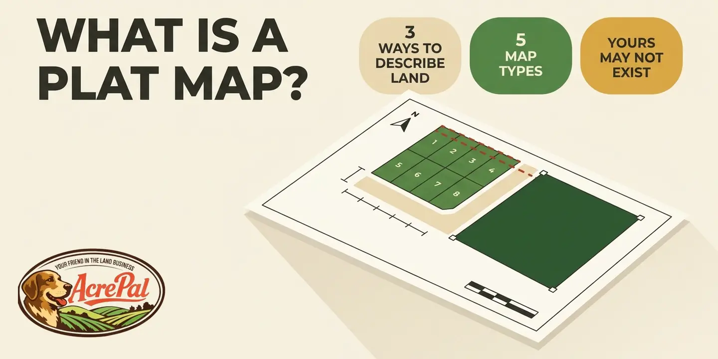
A plat is a recorded map that divides a piece of land into numbered lots and shows the streets, alleys and easements that go with them. The plat map is what you actually look at, whether that is a paper print from the county or a PDF on your screen.
That answer assumes your land was platted. A great deal of rural land never was, and that is normal rather than a problem.
So the useful question is not only what a plat is, but whether one exists for your land, and what stands in for it when none does.
Plat rules are set state by state and county by county, so treat this as general information rather than legal advice. Everything specific below is sourced to a statute or to a county's own website, and we name the source each time so you can go check it.
A Plat Is a Recorded Document, Not Just a Drawing of Your Lot
Three states write the definition three different ways, and one of them declines to define the word at all. Plat is a legal term of art, not a generic label for a map of your land, and the plat map definition you get depends on which statute you are reading.
The plat is the instrument that gets recorded with the county. The plat map is the copy you hold. A plat book is the bound volume the recorder files it in, which is why plats are cited by book and page rather than by address.
Florida writes the definition as a picture. Under Fla. Stat. 177.031, a plat or replat is "a map or delineated representation of the subdivision of lands, being a complete exact representation of the subdivision."
Arizona writes it as a process. A.R.S. 9-463 says a plat is "a map of a subdivision," then splits that into three stages. A preliminary plat is "a preliminary map, including supporting data, indicating a proposed subdivision design." A final plat is one "essentially conforming to an approved preliminary plat."
Only the recorded plat, "a final plat bearing all of the certificates of approval required by this article, any local applicable ordinance and other state statute," carries legal weight.
Colorado does not define plat on its own. Its survey statute, C.R.S. 38-51-102, defines three related terms, "land survey plat," "platted subdivision," and "subdivision plat." The last means "a map of a platted subdivision recorded for the purpose of creating land parcels which can be identified uniquely by reference to such map."
A lot-and-block description in your deed names the lot number, the block, the subdivision name, and the plat book and page where the map is recorded. The words in the deed do not draw the boundary, the recorded plat does. If your deed reads that way, a plat exists and you can pull it. How that paper relates to ownership itself is a separate subject, covered in our guide to deed vs title.
What Is Actually on a Recorded Plat
You open the PDF and get a wall of tiny numbers, abbreviations and symbols, and nothing on it says which line is yours. Learning how to read a plat map is easier if you start where the law starts, because the statutes spell out what has to be on the page.
Colorado's C.R.S. 38-51-106(1) sets out what every land survey plat must contain. Some of it is what you would expect, including "A north arrow" and "The signature and seal of the professional land surveyor." One item on the list is stranger. The plat must show "Any conflicting boundary evidence." The document is obliged to disclose the places where the evidence on the ground did not agree with itself.
Nevada is just as specific about parcel maps. NRS 278.466(3) requires "All monuments found, set, reset, replaced or removed, describing their kind, size and location" along with "Bearing or witness monuments, the basis of bearings, bearing and length of lines and the scale of the map."
Monuments are the physical markers at the corners, usually a capped iron rod or pipe driven into the ground. Found versus set is the most useful distinction on the whole drawing.
Found means the surveyor located a corner someone else had already established. Set means nothing was there and the surveyor put one in. Redfin's guide calls them markers "often placed in concrete along roads to indicate a property's boundary points," which is one narrow case rather than the general one.
| What the plat shows | What it means for you |
|---|---|
| Monuments found and set | Where a surveyor physically marked corners, and which ones already existed |
| Basis of bearings, bearing and length of lines | The reference direction and the recorded distance of every boundary |
| Any conflicting boundary evidence | Places where the ground did not match the record |
| North arrow and scale | Orientation, and the ratio for measuring off the drawing |
| Surveyor's signature and seal | The licensed professional accountable for the map |
Two more things on the drawing limit what you can build. A plat commonly draws building setback lines and references recorded covenants by instrument number. Zoning depth belongs elsewhere, in our piece on the R-2 zone, and the rights that ride along an easement are covered in what is a landlocked property.
Recording a Plat Gives Land Away, and Two States Do It Differently
Across the four pages ranking for this question, roughly 4,400 words, the word dedication does not appear once. We counted. Dedication is what turns a plat from a drawing into an instrument that changes who owns what.
Under Fla. Stat. 177.081, once a plat is signed, approved and recorded, "all streets, alleys, easements, rights-of-way, and public areas shown on such plat, unless otherwise stated, shall be deemed to have been dedicated to the public for the uses and purposes thereon stated." Nobody signs a separate deed for the road.
The same subsection adds that "nothing herein shall be construed as creating an obligation upon any governing body to perform any act of construction or maintenance within such dedicated areas" unless the county volunteers. A road can be dedicated to the public and still be a two-track nobody grades or plows.
Florida requires that "Every plat of a subdivision filed for record must contain a dedication by the owner or owners of record," executed by everyone whose signature would be needed to "convey record fee simple title to the lands being dedicated in the same manner in which deeds are required to be executed." It contemplates a plat "bearing the dedication executed by the owners of record and mortgagees having a record interest in the lands subdivided." A lender with a recorded interest signs too.
Colorado does something different. C.R.S. 31-23-107 reads, in full, "All streets, parks, and other places designated or described as for public use on the map or plat of any city or town or of any addition made to such city or town are public property and the fee title thereto vested in such city or town." Florida deems the areas dedicated. Colorado vests fee title outright.
Colorado's section lives in the municipal planning article and speaks to cities and towns, not unincorporated county land. Florida's Chapter 177 sits in Title XII, Municipalities. Neither is a nationwide rule.
An easement or road crossing your parcel is not a proposal. It was done the day the map was recorded.
There Are Three Ways to Describe Land, and Only One of Them Has a Plat
Your deed already tells you whether a plat exists. Almost nobody reads it that way.
AmeriTitle, roughly 400 words with no headings, states flatly that "not every property is platted" and hands you the test, "If your deed uses geographical references (like metes and bounds) then your property is not platted." id.land runs it from the other side, noting that "Lot-and-block descriptions in a deed usually mean the land is already part of a recorded subdivision plat" while "Metes and bounds (or similar) descriptions are more common for unplatted or irregular tracts." Three of the four pages do acknowledge unplatted land somewhere. Each does it in a single sentence, and none of them comes back to it.
American land records use three description systems, not two.
Lot and block points at a recorded plat, and the map is the boundary. Nearly every guide to plat maps is written about it alone.
Metes and bounds walks the perimeter in bearings and distances from a point of beginning. It needs no plat and usually has none.
PLSS aliquot descriptions are the norm across the West, where land was laid out under the federal survey rather than by a developer. Not one of the four ranking pages names the Public Land Survey System even once.
The BLM explains it plainly. The system "was established by law in 1785, under the Articles of Confederation." Townships are "for the most part 36 square miles or 6 miles square," and "Each township is broken down into 36 sections; each section is usually 640 acres." Section numbers run in a serpentine, "beginning with number 1 in the northeast corner of the township, and counting right to left then left to right and so on weaving back and forth."
The BLM's worked example, from its Oregon and Washington land records page, describes 160 acres as "the SE1/4 of Section 14 in Township 14 South, Range 34 East, Willamette Meridian." No lot, no block, no subdivision name, no plat book and page. It pins down 160 acres precisely and refers to no recorded map. For the arithmetic, see how many acres is a section of land.
This is not our theory. C.R.S. 38-51-106(1) requires a land survey plat to carry a written property description referencing "the section, township, range, and principal meridian or established subdivision, block and lot number, or any other method of describing the land as established by the general land office or bureau of land management." One clause, two systems, joined by the word or.
Run the test on your own paperwork. Lot, block and subdivision means a plat exists. Bearings and distances from a point of beginning means metes and bounds. Quarters of a section with a township, range and meridian means a PLSS parcel, and the county index may hold no plat of land at all.
Why Rural Land Often Has No Plat, Even When It Was Legally Divided
A perfectly legal division of rural land can produce a recorded map that is not called a plat. Go big enough and it produces no map at all.
Nevada makes this easy to see in the statute. NRS 278.471(1) routes a division onto a separate large-parcel track when each proposed lot is at least "One-sixteenth of a section as described by a government land office survey" or "Forty acres in area, including roads and easements." Nevada is not counting square feet there. It is counting aliquot parts of a PLSS section, and it names the government land office survey inside the statute.
What comes out the other end has its own name. NRS 278.472 requires that the resulting map be entitled "Map of Division into Large Parcels." Someone told to go check the plat on that parcel is searching the index for a word that was never used.
Above a full section, even that requirement falls away. Under NRS 278.471(3), a division into lots "each of which contains not less than one section or 640 acres, is not subject to" that track. Elko County is one of our own markets, so this is not hypothetical for us.
What counts as a subdivision in the first place changes from state to state.
| State | A subdivision starts at | Statute |
|---|---|---|
| Florida | "three or more lots, parcels, tracts, tiers, blocks, sites, units" | Fla. Stat. 177.031 |
| Arizona | "four or more lots, tracts or parcels of land," or two if a new street is involved | A.R.S. 9-463.02 |
| Nevada | "five or more lots, parcels, sites, units or plots" | NRS 278.320 |
Colorado belongs in the conversation but not in that table. Its Title 38 survey chapter defines the plat documents themselves rather than setting a lot-count threshold, so there is no comparable number to put in a column.
The same four-lot split creates a statutory subdivision in Florida and in Arizona, and does not in Nevada. The paperwork that comes out the other side differs accordingly, and so does whether the word plat appears on it anywhere.
A buyer in a suburban subdivision gets a plat at closing because the law required one to exist. A buyer of a 40-acre unimproved parcel may correctly have nothing, and that absence is not a warning sign. The division process itself, with its paths and acreage exemptions, is covered in our guide to how to subdivide a property.
Five Documents Land Buyers Mix Up, and What Each One Proves
You zoomed in on the county parcel viewer, screenshotted the outline around your lot, and now you feel like you know where the corner is. The county that published that map disagrees, in writing.
Nevada names five distinct recorded map types in one sentence. NRS 278.473(1) sets out how to correct an error in any recorded "subdivision plat, record of survey, parcel map, map of division into large parcels or reversionary map." Five documents, one statute, none of them interchangeable. The set a buyer actually runs into is a little different, because the two that people lean on most are not recorded maps at all.
| Document | Who makes it | What it proves |
|---|---|---|
| Recorded subdivision plat | Surveyor for the owner, approved by the governing body | That the lots exist as drawn, and what was dedicated to the public |
| Boundary survey or record of survey | Licensed land surveyor | Where the lines run on the ground now, and what was found there |
| Parcel map or large-parcel map | Licensed surveyor, recorded with the county | A small or rural division that never became a subdivision plat |
| Assessor parcel map | County assessor | Which parcel is taxed to whom. See what is APN in real estate |
| County GIS parcel layer | County GIS staff, compiled from many sources | Roughly where to look, and nothing about a boundary |
California adds a wrinkle, because the office is different. Cal. Bus. and Prof. Code 8762 requires a licensed surveyor or civil engineer to file a record of survey "with the county surveyor in the county in which the field survey was made," not with the recorder, whenever the fieldwork turns up a "material discrepancy" with existing maps. That statute repeatedly measures new evidence against maps "maintained by the Bureau of Land Management of the United States," tying state boundary law straight back to the federal survey.
On the GIS layer, do not take our word for it. Take the counties' own words.
Mohave County, Arizona publishes this on its GIS page, capitals included. "THE VIEWER IS NOT TO BE USED FOR NAVIGATION, PROPERTY DESCRIPTIONS, OR DETERMINATION OF LEGAL TITLE. Property descriptions must be obtained from surveys or deeds."
Elko County, Nevada states that its "Parcels are for graphic representation only and are not intended to be used for any measurement, calculation, or delineation purposes."
Apache County, Arizona says of its parcel viewer that "No portion of the information should be considered to be, or used as, a legal document," and cites A.R.S. 37-178(C) on that same page as the basis for sharing geospatial data without liability.
Three counties, three disclaimers, every one of them written by the office that made the map. You can go read them yourself.
How to Actually Pull a Plat, and Why Calling the County Often Fails
Start with the deed, not the county. The plat book and page in your legal description is the plat's address in the county's records, and it turns a fishing expedition into a lookup. Without it you hit a wall.
Mohave County's Recorder describes its filing system in one sentence. Its records "are indexed in various indices by grantor, grantee and recording date." The index is built around names and dates, not around your parcel number or your address. A buyer holding only an APN can watch the clerk come up empty on a document that is definitely in the building.
Which office holds what changes at the state line.
- Arizona, Mohave County. The Assessor publishes seven separate map families, "Parcel Plat Maps," "Railroad Maps," "Record of Survey Maps," "Right of Way Maps," "Subdivision Maps," "Survey Maps" and "Historical Reference Maps." Parcel Plat Maps and Subdivision Maps are two different products on that menu. Recorded subdivision plats sit with the Recorder.
- Nevada, Elko County. The Recorder holds "all filed land survey maps," its records "start in March 1869," and "There is no charge for use of the records," though statutory fees still apply for recording and certified copies. The word plat does not appear on that page at all.
- Florida, Putnam County. The recording office is the Clerk of the Circuit Court. Official Records go to the County Recorder, "which in most Florida Counties is the Clerk," and "Plats, Maps" are among them.
- California, Modoc County. A combined Recorder and Assessor office whose listed duties include "Map Recording - Filing and maintenance of subdivision and survey maps in compliance with the Subdivision Map Act."
Modoc publishes the line every buyer should read first. "The staff of the Recorder/Assessor's Office is forbidden by California legal codes to practice law or provide legal advice; this prohibition includes advising about what forms you might need or how you should fill them out." The office holding your document is not allowed to explain it to you.
One of the six counties we sell in would not serve its records pages to us while we researched this, and archived copies were unavailable too. Plenty of rural systems still require a phone call, an in-person visit or a paid portal login, and that is not a failure on your part.
We sell owner-financed rural land in Mohave and Apache counties in Arizona, Costilla in Colorado, Elko in Nevada, Modoc in California and Putnam in Florida, which is why those six are the ones we checked, and our current listings are at AcrePal. If the parcel has no street address yet, we walk through that separate errand in how to get an address for land.
When the Plat and the Ground Disagree
A plat can be perfectly accurate and still not tell you where your corner sits today.
Redfin's guide offers a rule of thumb. "If the plat map you're using was created within the past five years, you can rely on it to be mostly accurate. However, older maps are more likely to have discrepancies due to weather events and other changes."
Most of that page is a reasonable explainer. This claim is not. No source is given for the five-year line, and weather is not how a recorded plat stops matching the ground.
Monuments move or vanish. A plat records what one surveyor found and set on one day. Corner markers get pulled by equipment, buried under fill, or replaced by someone with a shovel and an opinion.
The document may have changed since your copy was made. Under NRS 278.5695, a recorder maintaining a cumulative index must note on any copy it provides that "subsequent changes to that document should be examined." Plats get amended and vacated. Your PDF does not update itself.
Occupation drifts. Fences, driveways and field edges shift by feet over decades and quietly outrun the paper line.
The underlying survey may have been waived. NRS 278.463 lets a county surveyor, city surveyor or appointed professional land surveyor "waive the requirement of a survey" for a parcel map when a survey is not needed to accomplish the statute's purposes.
A plat gives you the shape of the lot, the easements, and where you are allowed to build. It does not tell you where to drive a fence post. Before you build near a line, split a parcel or argue with a neighbor about a corner, pay a licensed surveyor to go find it.
Plat Map FAQs
How do I get a plat map of my property?
Start with your deed. If the legal description names a lot, block, subdivision and a plat book and page, take that citation to the county recorder or clerk and ask for that book and page directly. The office name changes by state, recorder in Arizona and Nevada, clerk of the circuit court in Florida, and a combined recorder and assessor in some California counties.
What is the difference between a plat and a survey?
A recorded plat is the approved map that created the lots, filed once and rarely touched again. A boundary survey is a licensed surveyor's field determination of where those lines sit today. In California, the filed version of that second document is called a record of survey, and state law sets out when one must be filed.
What if there is no plat for my land?
Nothing has gone wrong. Metes-and-bounds and PLSS-described rural parcels frequently have no recorded plat because none was ever required. Read your deed's description first, then look for a record of survey, a parcel map, or in Nevada a map of division into large parcels. One of those is usually the substitute.
What is a plat book?
The bound volume where the county recorder files recorded plats. It is also why a plat carries a book and page number instead of a street address, and why the citation sitting in your deed is the fastest route to yours. Many counties have digitized their plat books and put the images online. Plenty have not.
Can I use a plat map to find my property lines?
Partly. A plat map for property lines shows the lines as recorded, along with dimensions and easements. It does not locate those lines on the ground, and neither does a county GIS viewer, which Elko County's own site describes as graphic representation only. Finding the actual corner takes a surveyor.
Is a plat map the same as an assessor's parcel map?
No. Different offices, different purposes, different legal weight. A recorded plat was approved and filed to create the lots. An assessor's parcel map exists so the county can tax the right parcel to the right owner, and it is not evidence of where a boundary runs.